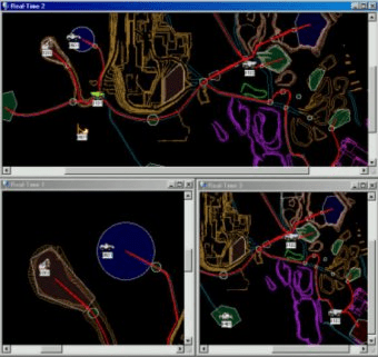
MineVision displays selectable maps of haul roads and other features in the mine, superimposed with a dynamic representation of equipment location and status. MineVision imports the mine’s .dxf file from the autocad program or mine planning system, and overlays haul roads, equipment icons, locations, equipment status, GPS addresses and dump locations. This visual representation of the mine readily shows the deployment of equipment and helps for quick identification.
Comments